Day 35 – Volcano Hike (12/06/19)

It was an early start to climb the Santa Ana Volcano which always makes me happy – not. Luckily Luis treated us to banana pancakes and won my undying affection.

Amazing pancakes

Only one bus a day goes as far as the volcano so we so grabbed the 7:40 bus and on the way we passed Lago de Coatepeque, which is a volcanic caldera. We then hung around for over an hour waiting for the guide to leave at 11am with a group of us because they hide the entrance. However along with the guide you also get an armed security guy to follow the group and make sure no one gets robbed. So at least you feel safe.

Lago de Coatepeque from the bus

The climb was pretty steep and reaches a total height of 2,831m above sea level. Fortunately you don’t start at sea level, so this was actually a relatively easy climb and took a bit over an hour.

The path up is pretty good, though you scramble a little more near the top

On the way up we could see Izalco Volcano – another stratovolcano on the southern flank of Santa Ana. Izalco was nicknamed “lighthouse of the pacific” because it erupted continuously from its formation in 1770 up until 1958, but it is now quiescent so we didn’t see any lava today.

Izalco volcano
Izalco between the clouds from the top of Santa Ana

Santa Ana Volcano is a large stratovolcano, surrounded by vents and cinder cones on its lower flanks. The top of the volcano actually contains four nested calderas, with a small crater lake in the centre. It last erupted as recently as 2005, with rocks the size of cars landing up to a mile away – two people were killed and seven injured. Thankfully it didn’t make even a peep when we were up there!

At the top of the volcano the caldera is filled with acidic water and we could see it steaming and bubbling away. There was a slight smell of sulphur, but not too strong as there was a good breeze. You could see the convection of the clouds as they fell into the caldera before being warmed by the crater lake and rising again out of the caldera, it was quite surreal.

Crater lake in the innermost caldera
We made it to the top
Heading back down the volcano

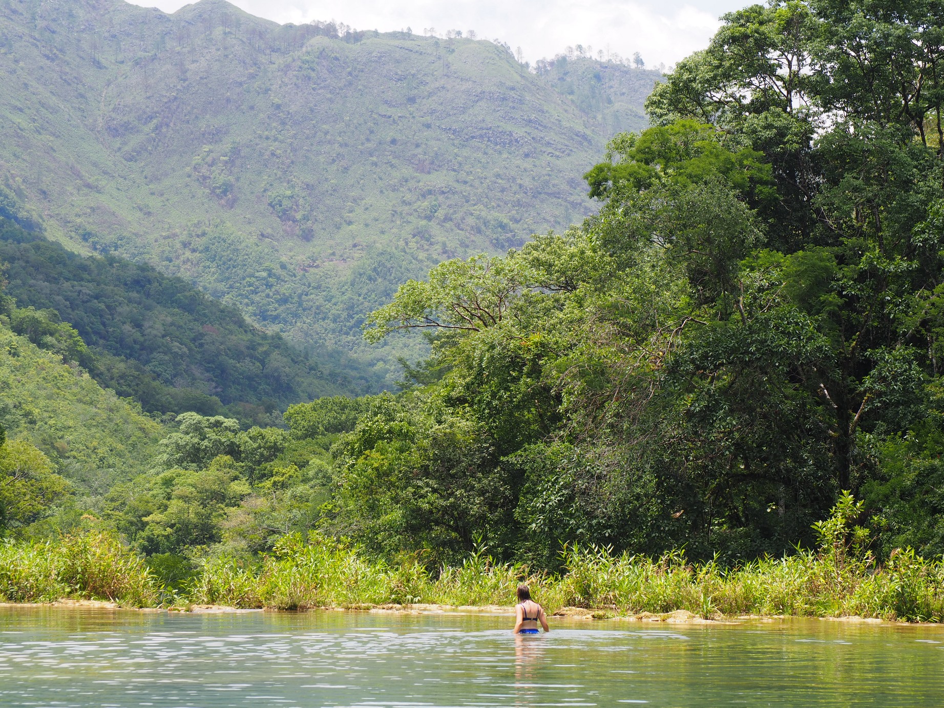
On the way back down the volcano we went up a viewing platform to get a better photo of Lago de Coatepeque. The lake is actually a volcanic caldera which was formed during explosive eruptions between 52,000 and 70,000 years ago. It still has some hot springs at the edges today and is about 10 square miles in total.

That must have been one very big eruption

We had an hour or so to wait for the only bus back to Santa Ana, and finally got to use our rain coats in earnest. Fortunately we were waiting in the right place, as some locals flocked out at the last minute to grab the bus.

Waiting for the bus in the rain

This time we managed to get a papusa and they are seriously good. I also had a hot chocolate since I was still cold from the climb at the volcano. This is so far the best hot chocolate in all of central america, it was soooo good.

Pupusas are great – rice or maize based and stuffed with mostly cheese based fillings

Day 34 – Joya de Cerén (11/06/19)

We took a number of chicken buses to our seventh UNESCO of the trip – Joya de Cerén. Joya de Cerén means Jewel of Cerén in Spanish, and the site was added as a UNESCO in 1993. It is basically Pompeii but less impressive because all the peasants were much more clued up than the Romans and went away when the volcano erupted. However, you can have a look at the remains of their preserved houses which are very different from the stone temples we have seen previously from the Mayans.

UNESCO number seven

Going around I pulled a fast one and joined an English speaking tour that was already going on. In the end the guide actually invited us to listen in instead of us follow subtly behind him – maybe we weren’t that subtle?

In 600AD the village was buried under 10m of volcanic ash from the eruption of the Loma Caldera on San Salvador volcano. Because the ash fell quickly and was at a relatively low temperature, the majority of the structures were preserved, with only organic material burning away. The eruption was likely preceded by small earthquakes which gave the inhabitants plenty of time to get out of the way.

Most of the buildings were constructed using a wooden frame on to which clay/mud was packed to bake in the sun. Roofs were generally thatched, so the hot ash burned away the roofs, but didn’t really affect the walls, though a few collapsed under the weight of ash. This gave us the opportunity to see how the majority of Mayans lived.

The shaman’s house building is raised up, so that visitors ascend towards the gods when visiting. It is one of the few buildings to have a “window” – or in reality small holes patterned to provide ventilation without allowing anyone to see in. The layout of the building is complex so that there are no direct lines of sight into the inner areas, this was to prevent bad spirits from entering as well as to trap good spirits within. It also had a little waiting room bench outside and areas for offerings to be left as payment to the shaman.

Scale reconstruction of the shamans house
Shaman’s house – you can see the wooden frame sticking out of the top of the walls

We also saw a replica of the sweat lodge. It’s surprisingly roomy inside and would have been used as a communal area for bathing/expelling bad spirits. It also doubled as a maternity area according to our guide, though no one was sure how a 9 month pregnant woman is meant to crawl through the door. Heat is piped in from external furnaces, similar to Roman construction methods and the temperature inside can be regulated by a bung in the ceiling to let heat out if required, making it a reasonably sophisticated construction for a small village.

A full size replica of the sweat lodge has been built nearby
Here is the excavated original
Entrance is quite small to get through though

We then took a bus to Tazamul ruins which were small and much less impressive than other Mayan sites we have been too. The structures were covered in concrete by Stanley Boggs during reconstruction in 1942-44, as he deemed it sufficiently similar to the original appearance. Interestingly it seems to break down and require more maintenance than other sites we saw which were left as they were.

The whole temple has been clad in concrete at some point

We took the bus back to Santa Ana in search of papusa but everything was shut on a Tuesday. Luckily an Argentinan street food van was there and we had choripan, a grilled sausage sandwich served with chimmichurri and salad. They tasted great, so good in fact we had two each!

Choripan is a winner
Argentinian street food is the only thing going on tuesdays

Day 33 – Travel to El Salvador (10/06/19)

We took a number of buses today but luckily everything went smoothly. We started with a collectivo at 7:20am to the Guatemala border to get our stamp. Then we caught a bus to Jocatan and the assistant was very helpful in taking our bags and placing them on the next bus we needed. We ended up at a crossroads in the middle of nowhere but only had to wait 10mins for a bus which luckily went all the way directly to the El Salvador border.

Border crossings are all on foot – sometimes with a good distance between countries

After crossing immigration in to El Salvador we then went on to our first colourful chicken bus to Metapan, then a longer bus ride to finally arrive at Santa Ana. Phew that was a lot of buses, but we arrived at 2pm so all in all made pretty good time. Although Honduras and El Salvador share a border it was actually much quicker for us to go via Guatemala and avoid the large mountain range that would otherwise mean a very long detour south.

Chicken busses are old US Bluebird school busses with a new paint job

Portions of the El Salvador/Honduras border remain disputed today, even with UN rulings in place. Some of the disputes are unresolved since the 1969 “Football War” between the two countries. Both countries had vast wealth inequality between the ruling classes and the general population. However when rioting ensued at the 1970 World Cup qualifiers between the two countries, the riots were a flash point and were used as an excuse for El Salvador to invade Honduras. Both countries governments blamed each others citizens for the inequality of course, not the ruling wealthy people…

We stayed in a lovely B&B and Luis our host was great at giving us advice on where to eat and how to navigate around the country. Definitely stay at Casa de Vieja if you are in the area. He recommend a lovely restaurant (Keka’s Place) complete with old TVs and radios in walls which had the best burger in central america as far as we could tell.

Amazing burgers and colourful drinks at Keka’s place

The liberty square in Santa Ana is dominated by the Catedral de Santa Ana on one side and the theatre on the other. It’s nice to visit a park that’s so well used by the locals.

Busy park on a Monday afternoon
Catedral de Santa Ana
Old colonial architecture is everywhere in Santa Ana – this is still in use as the theatre today

Day 32 – Copan Ruins (09/06/19)

Today we went to our sixth UNESCO. Yes, we went to Honduras solely to get another UNESCO ticked off – achievement unlocked!

It was a pleasant walk to the Copan ruins and at the entrance we saw many macaws feeding. Macaws are the national bird of Honduras and they have been reintroduced into the area from 2011.

Macaws are about as loud as their feathers

Macaws were very important for Mayan culture and they used the feathers to decorate their headdresses. In Copan the ballcourt had images of macaws as part of the decoration showing how revered they were.

Ballcourt with Macaw heads at the top of the ramps
Replica Macaw head carvings – in some centuries they preferred a more abstract style

The most impressive part of the Copán ruins was the staircase, this has inscriptions running up and down, and is believed to be the largest discovery of Mayan text in the world. The text is a chronological record of Copan’s rulers and their achievements. Translating it completely has been made difficult however as this was only realised quite recently (1980s). In the 1930’s an attempt at reconstruction was undertaken without this understanding and with no idea how to read Mayan it meant many blocks were incorrectly re-positioned. More recent restoration has un-jumbled the blocks and made good progress on translating the text. Fortunately the lower 15 steps of the staircase were intact so could be used as a key to decipher the staircase’s meaning.

The hieroglyphic stairway contains over 2200 glyphs

Copan is one of the southern most Mayan cities and was surrounded by non-mayan cultures. As such it developed a very distinct style to emphasise its Mayan control. Copan was a large city in control of this region, though it had a 17 year hiatus after its ruler was captured and killed by Quirigua’s king (as we found out when we visited Quirigua). Copan was strongly linked with Tikal as its ruling dynasty originated there. You can still see the impressive stelae built by 18 Rabbit before his capture and execution, the subsequent lack of stelae indicate Copan’s fall from power for the following decade or so.

Copan’s 13th ruler “18 Rabbit” erected many impressive stelae

From its peak of 20,000 people, the cities population declined in the 8-9th centuries dropping to only 5,000. However buildings didn’t begin to deteriorate for another 400 years as they were so well built. When the Spanish arrived the site was largely deserted with only farming hamlets in the area.

We also went to the museum within the site and were wowed by the replica of the Rosalila Temple in the centre. The original temple still exists buried beneath temple 16. The Mayans traditionally built their temples on top of each other so archaeologists can learn more about previous ages by tunnelling through the current temple to see what was previously there. The Rosalila temple was exceptionally well preserved and archaeologists even found offerings still within the temple.

Full size reconstruction of the Rosalila Temple

We then had the left over meat from the previous day and watched a huge thunderstorm roll in. At least it’s consistently at around 4pm you are going to get wet.

Thunderstorms are big here

While we waited for rain to end so we could have dinner, we changed our itinerary and added El Salvador to our list of places to go to. We will be going tomorrow on a number of chicken buses, hear more about that in our next post.

Comedor food again – cheap quick nachos and quesadillas between rain storms

Day 31 – Travel to Honduras (08/06/19)

We are moving on to a new country today. However I definitely have a sore throat so it’s ice cream and crisps breakfast for me.

It was a nice early boat ride to leave our accommodation in time for the bus
The fresh air woke us up though

We took a coach to the border at el Florido and then passed through immigration quickly to get through to Honduras. A collectivo was there to take us to Copan Ruinas and was very nice in taking us straight to our hostel in the rain and helped us with our bags. It was particularly entertaining when the driver tried to take us up one of the cobblestone roads up a hill at least 45 degrees and failed half way up – “No es quatro y quatro!” The torrential rain made all of the cobblestones very slick so we had to slither back down and find an alternate way up.

Cinnamon tea to wait for the rain to pass

We then waited for the rain to go away so we could grab dinner. Rainy season in Copan is certainly dramatic; the rain was coming down heavily for at least two hours. Our hostess didn’t speak any english, but we had enough spanish to get by and she was so welcoming and kind – kept us topped up with cinnamon tea at every opportunity!

Our meal in Copan made up for the rain though, we had more meat than I knew what to do with – we even took some back home with us for the next day.

All types of grilled meat
The kitchen is just one big grill as far as we could tell

Day 30 – Hammocks at Rio Dulce (07/06/19)

Today was a chill day to catch up on blog posts and precious hammock time. Sadly I’m feeling like I’m coming down with a cold – it’s 30’c! Surly this shouldn’t be allowed!

A good breakfast to set us up for hammock challenges that lie ahead
Tough time mastering hammock skills

The place we are staying is really interesting. It’s down a narrow canal and in a swamp area. Sadly this does mean mosquitos but we have been seeing them everywhere anyway and at least here we get a net over the bed.

Our room was detached from the main building down a board walk through the swamp
The windows only have mesh, no glass
Amazing mosquito net for the bed at least

With a tough day behind us some comfort food was required – call out the emergency carbonara. Eat quick before the mosquitoes descend on you though.

Day 29 – Quirigua Ruins (06/06/19)

Today we went to visit our fifth UNESCO. After taking a boat from our hostel to the centre of Rio Dulce we were lucky and grabbed a collectivo straight away heading in the right direction. We ended up taking several collectivos to Quirigua ruins after one bus driver told us he was heading the right way but instead we pointlessly ended up at the main bus station in Morales only to pass back by the same cross roads we had tried to change at about 45 minutes before.

It was a good 30min walk from the highway to the ruins and there were Tuk-Tuks offering to drive us but we decided to walk since it was a nice day. On the way we passed a Del Monte banana plantation. When the United Fruit Company established the plantation in 1910 it fortunately set aside the area containing the ruins. Later a further area was donated by the plantation to protect the archaeological area and its surrounding ecology. 

Bananas grow in plastic bags it seems

The bunches of bananas were all shrouded in special plastic bags. This apparently helps reduce blemishes on the skins and they can often be impregnated with insecticides to help protect the crop.

Quirigua was made a UNESCO in 1981 because of the stelae. The stelae were very impressive and towered over us. The front and back typically depicts the ruler, while the sides contain hieroglyphs detailing the impressive event for which the stela was carved. 

UNESCO sign

The stelae at Quirigua are so well preserved due to their construction from the local sandstone. Compared to materials used for stelae at other Mayan sites it is soft enough to carve (hence the dramatic reliefs), yet hardens and weathers far better than the limestone found in the Yucatan for example.

Stela F used to be the tallest at 7.3m until stela E was built

Stela E actually toppled over in 1917 after a particularly heavy rainstorm, amazingly it survived intact. The archaeologists of the day then attempted to lift it back in to position, but its 65 ton bulk broke the cables used and tragically the stela snapped in two! It has now been cunningly restored and reassembled, so perhaps stela F can reclaim its title as the largest monolith of the Mayan world?

Stela E tallest Mayan stela to be discovered at 10.6m including 3m buried below ground

Both stela E & F depict the ruler Cauac Sky who ruled Quirigua between 724-785AD. Quirigua was a vassal state to Copan and thus Cauac Sky was crowned by Copan’s ruler. However through his reign Cauac Sky broke away from Copan, declaring independence by capturing the ruler of Copan who had crowned him. There isn’t any evidence of outright war between the states though and it seems Quirigua gained control of trade routes and flourished for a while as a regional capitol. It did however remain small <2000 people, it is thought that Copan did not retaliate due to alliances Quirigua held with Calakmul in the north (who possessed a much stronger military force). Calakmul gained an advantage as weakening Copan will have in turn weakened its more direct rival Tikal.

Claire’s favourite tree on the site – bigger than the stelae by far

One of the stelae showed the beginnings of equality as the king was shown not to be a god above the people. Instead the stelae are shorter so using scale to place the king at the level of the people.

Stela K is short to bring the ruler equal to his people

The acropolis at the site was much less impressive than other Mayan sites we had been too. There wasn’t even a pyramid to climb but at least that saved my legs after the long walk there!

Partial reconstruction of the acropolis

I thought the carvings on the zoomorphs were really intricate, particularly zoomorph P which shows the ruler Sky Xul sitting in the jaws of either a turtle or a crocodile-mountain monster and holding a scepter. Incredibly it is carved over its entire 20 square meter surface and weighs about 20 tons.

Zoomorph P

On the way back we passed a farm with cows which looked like they were from India. A short google later and we learned that they are in fact most likely Nelore cows which were bred from Indian Ongole cattle. Both breeds survive well in high temperatures with poor grazing or water and they were introduced to Central America from India to improve the hardiness of the local cattle. 

Interesting cows?

We went over the famous Rio Dulce bridge which is known as one of the largest bridges in Central America. The Rio Dulce harbour is used by yachts as a hurricane hole to shelter during hurricane season. While we saw a good number of stored/parked boats around the area there didn’t seem to be too much activity, as hurricane season hasn’t really started.

Rio Dulce bridge

We were getting peckish by this point so we went to a comedor for lunch. This is where the locals hang out and you get a plate of the one or two things they are serving. On this occasion a chicken stew with rice and a pasta salad, along with a drink each for less than £2 each.

Super cheap, yet tasty chicken stew

Sadly while waiting for our boat ride back to our accommodation Claire was forced to try a Pina-Colada Daquiry

Pineapple Daquiry time

Day 28 – Castle of San Felipe de Lara (05/06/19)

It was an early start today to get across Guatemala to Rio Dulce. Technically it was doable by local collectivos but we grabbed the tourist shuttle bus just to be safe.

Steadily everyone who was leaving by shuttle bus from all the local hostels lefts until it was just us. This wasn’t worrying at all! We kept on asking if the bus was coming and told “soon, soon.” Finally at 9:30 after leaving the hostel at 6:45 our bus arrived and it was just us in the minivan. Nice! I got to spread out over a whole row of seats and re-watch Good Omens because it was so good it deserved a second viewing. Occasionally I looked up to take in the view as we left the mountains.

Serious geography lies between Semuc and the rest of the world

We arrived around 1pm at Rio Dulce because we asked for no stops on the way. Our accommodation for Rio Dulce was across the water and we had to ask a bar to ring them up for a boat to take us in. We had a pizza to share there and they let us leave our backpacks at the bar so we could explore the area.

We took a collectivo to the Castillo de San Felipe. The fort was constructed at the narrow point between the Rio Dulce and the Lago Izabal in order to defend the port of San Antonio de las Bodegas against English pirates from Belize. San Antonio was an important port to the Spanish as it was the main connection to supply Spanish forces in Guatemala. It was active for several centuries, and was captured and looted by pirates several times in its history. It was originally built in 1644 to replace a tower that was destroyed in 1604.

Kinda a small fort if we are honest about it
Cannon surfing
Claire has checked in to the accommodation for the night

On the way back we clearly picked a busy time because we ended up on the busiest collectivo yet with 26 people somehow fitting in. Some were sitting on each other, others standing and some clinging on to the outside by the open sliding door. I was glad it was a short journey. Then we grabbed the boat to our hostel.

Boat is literally the only way to get to our accommodation in Rio Dulce

Day 27 – Semuc Champey (04/06/19)

We had a huge egg burrito breakfast and it was incredibly filling, but we needed it because we were going to hike a mountain.

Burrito time

Well it turned into less of a hike and more of a steep path over slippery rocks and steps up a mountain. It was worth it for the view over the river at the el mirador (viewpoint).

We found it
The climb up is a bit slippery after its rained

Semuc Champey consists of a natural 300 m limestone bridge, under which passes the Cahabón River. Atop the bridge is a series of 18 stepped, turquoise pools, where you cans go swimming.

Its actually kind of hard to get a person in shot with the pools
The pools are a fraction of the river as it mostly flows beneath them

We spent a lot of time swimming in the pools and being eaten by the fish.

Setting up for a L’Oreal advert
A creature emerges from the depths
The river re-emerges downstream from the pools as thundering rapids

When the shadows from the mountains started covering the water we walked back to the hostel and enjoyed the hammock seats and listened to the music the hostel had playing over the speakers. Eerily the rain started exactly when Rod Stewart’s “have you ever seen the rain” started playing the chorus line. Clearly something weird was happening so I had a donner kebab wrap and then quickly to bed.

Kebab to finish off the day
Hostel is also replete with many hammocks and doggos